


Highlights
View Details- 5-in., glove-friendly touchscreen handheld GPS navigator with easy-to-view color display; available with versatile mounting options (sold separately), depending on your activity
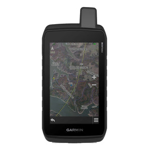
- Navigate your adventures with included TopoActive maps and the ability to download additional maps, such as City Navigator maps for streets and BlueChart g3 charts for water (sold separately)
- Rugged construction is rated to MIL-STD 810 for thermal, shock, and vibration and IPX7 for water-resistance
Garmin Montana 710 5" Rugged Handheld Touchscreen GPS Navigator, Black (010-02963-00)
Log in to see pricing
Same-day Shipping
This product usually ships and arrives up to 1 - 2 days
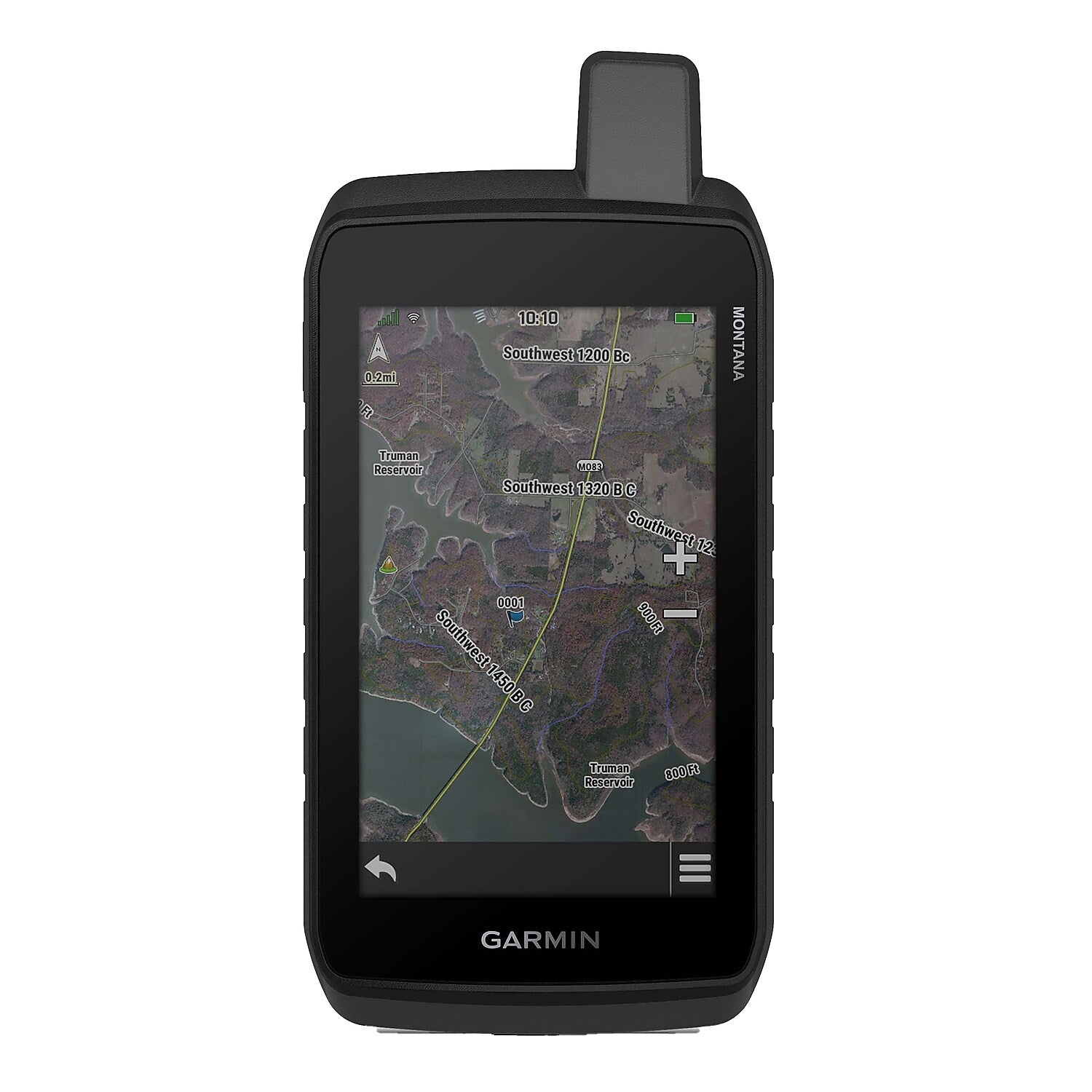
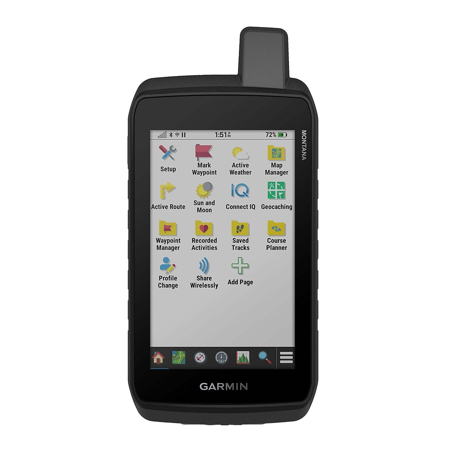
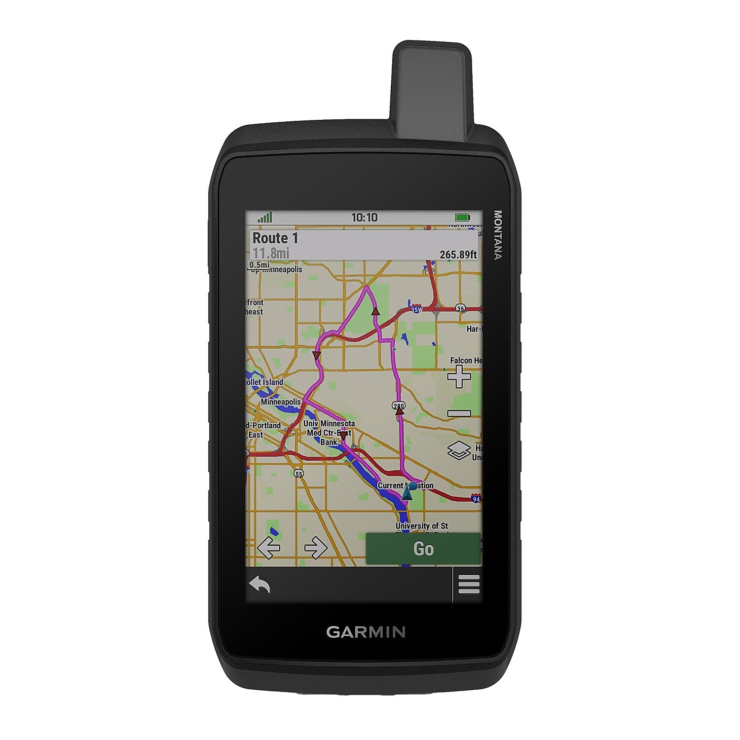
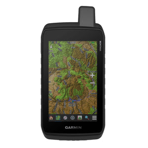
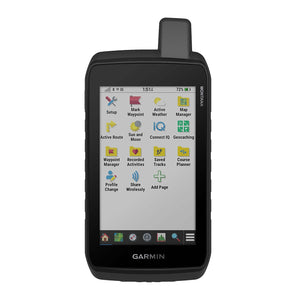
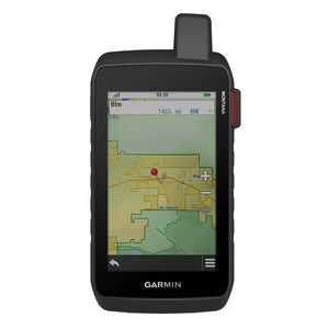
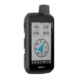
Stay on track and in touch with the rugged Montana® 710 Handheld GPS Navigator from Garmin®. Built to guide you through all kinds of adventures, it includes TopoActive mapping and a glove-friendly 5-in. color touchscreen. Expanded 32-GB memory capacity lets you store more maps to keep your expeditions on course. High-resolution satellite imagery, available via subscription-free, direct-to-device downloads (requires a connection with Wi-Fi® technology), shows a clear overhead view of your route and surrounding terrain. Get the on- or off-road capabilities you need with multi-GNSS satellite network support and ABC sensors. Add ongoing access to Outdoor Maps+ (sold separately) for a wide variety of premium mapping content. Plan and review trips with the Garmin Explore™ smartphone app. And explore longer with up to 24 hours of battery life in GPS mode and up to 432 hours in ultralow-powered expedition mode. This handheld GPS device recharges easily with the provided USB-C® cable. Plus, the Montana® 710 meets MIL-STD 810 for thermal, shock, and vibration and is rated IPX7 for water resistance.
- 5-in., glove-friendly touchscreen handheld GPS navigator with easy-to-view color display; available with versatile mounting options (sold separately), depending on your activity
- Navigate your adventures with included TopoActive maps and the ability to download additional maps, such as City Navigator maps for streets and BlueChart g3 charts for water (sold separately)
- Rugged construction is rated to MIL-STD 810 for thermal, shock, and vibration and IPX7 for water-resistance
- Downloadable high-resolution satellite imagery shows photorealistic overhead views and lets you create waypoints based on landmarks
- Expanded 32 GB memory capacity lets you store additional maps and more to keep your expeditions on course; with a subscription to Outdoor Maps+ (sold separately), get ongoing access to a wide variety of premium mapping content, which you can download to your navigator via Wi-Fi technology
- Operates with built-in, rechargeable high-capacity Li-Ion battery or traditional AA batteries (not included)
- With Li-Ion battery: up to 24 hours battery life in GPS mode, up to 432 hours in expedition mode, and up to 1 year if powered off
- Includes micro-USB-C cable and documentation
| Manufacturer # | GRM01002963 |
| Battery Life | 8.5 hours + |
| Bluetooth | Yes |
| Brand Name | Garmin |
| Depth in Inches | 1.3 |
| Gps Coverage | North America |
| Gps Map Type | Topographical |
| Gps Type | Portable GPS |
| Height in Inches | 7.2 |
| Internal Memory (gb) | 32 |
| Lifetime Updates | No Lifetime Updates |
| Power Supply | Battery, USB-C |
| Screen Size in Inches | 5 |
| Series or Collection | Montana® |
| Touch Screen Enabled | Yes |
| True Color | Black |
| Warranty Information | 1 Year |
| Width in Inches | 3.6 |
Details
Stay on track and in touch with the rugged Montana® 710 Handheld GPS Navigator from Garmin®. Built to guide you through all kinds of adventures, it includes TopoActive mapping and a glove-friendly 5-in. color touchscreen. Expanded 32-GB memory capacity lets you store more maps to keep your expeditions on course. High-resolution satellite imagery, available via subscription-free, direct-to-device downloads (requires a connection with Wi-Fi® technology), shows a clear overhead view of your route and surrounding terrain. Get the on- or off-road capabilities you need with multi-GNSS satellite network support and ABC sensors. Add ongoing access to Outdoor Maps+ (sold separately) for a wide variety of premium mapping content. Plan and review trips with the Garmin Explore™ smartphone app. And explore longer with up to 24 hours of battery life in GPS mode and up to 432 hours in ultralow-powered expedition mode. This handheld GPS device recharges easily with the provided USB-C® cable. Plus, the Montana® 710 meets MIL-STD 810 for thermal, shock, and vibration and is rated IPX7 for water resistance.
- 5-in., glove-friendly touchscreen handheld GPS navigator with easy-to-view color display; available with versatile mounting options (sold separately), depending on your activity
- Navigate your adventures with included TopoActive maps and the ability to download additional maps, such as City Navigator maps for streets and BlueChart g3 charts for water (sold separately)
- Rugged construction is rated to MIL-STD 810 for thermal, shock, and vibration and IPX7 for water-resistance
- Downloadable high-resolution satellite imagery shows photorealistic overhead views and lets you create waypoints based on landmarks
- Expanded 32 GB memory capacity lets you store additional maps and more to keep your expeditions on course; with a subscription to Outdoor Maps+ (sold separately), get ongoing access to a wide variety of premium mapping content, which you can download to your navigator via Wi-Fi technology
- Operates with built-in, rechargeable high-capacity Li-Ion battery or traditional AA batteries (not included)
- With Li-Ion battery: up to 24 hours battery life in GPS mode, up to 432 hours in expedition mode, and up to 1 year if powered off
- Includes micro-USB-C cable and documentation
| Attribute Name | Attribute Value |
|---|